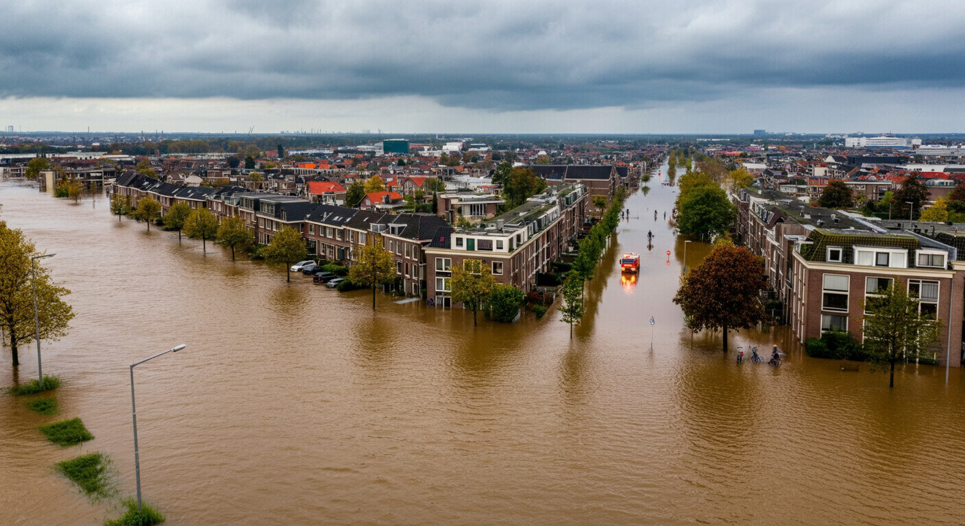
The Netherlands has a long-standing relationship with water. Much of the country lies below sea level, and the infrastructure to manage that is world-class. But climate change is introducing a different kind of water problem: intense rainfall events that deliver more precipitation in a short period than urban drainage systems can handle. Flooding in streets, basements and homes is no longer an exception in Dutch cities.
For insurers, this means a growing volume of claims after every extreme weather event. And with that, a growing verification problem.
The Verification Problem During Calamities
After a major storm or heavy rainfall, hundreds or even thousands of damage claims arrive in a short window. Every file contains photos: flooded basements, damaged facades, trees toppled onto cars. Insurers need to process these claims quickly, but simultaneously face a fundamental question: were all those photos actually taken at the addresses stated in the claims?
The problem is structural. Not every claim is fraudulent, but the circumstances following a calamity are ideal for opportunism. Photos of flooded streets spread rapidly on social media. Someone could pick up a photo of a flooded basement from the internet and submit it as if it were their own. Someone with minor damage could add photos from a more severely affected property nearby.
Manual verification at scale is nearly impossible. Loss adjusters cannot visit every address. And even if they could, most damage is repairable or disappears once it dries out.
Geolocation as an Objective Check
AI photo geolocation offers a more scalable alternative. By analysing the visual content of a photo and matching it against known locations, the system can predict where the photo was taken.
For claims processing, this means: a photo of a flooded street can be compared against the actual street at the stated address. Does the system recognise the facade, the dormer windows, the cobblestone patterns or the street furniture? Does the street profile match the environment of the address?
GeoPin is specifically trained on Dutch street imagery. Its fine-grained index of Dutch addresses and environments makes it effective for local verification, including the typical architecture of terraced houses, gallery flats and commercial properties that insurers encounter most often.
Two Roles: Prevention and Acceleration
Photo geolocation in claims processing serves two complementary functions.
Fraud prevention: Claims where submitted photos visually do not correspond to the stated address receive a low confidence score. This is a flag for additional manual review, not an automatic rejection. But it helps claims handlers direct scarce adjuster capacity toward the cases that most warrant closer attention.
Accelerating legitimate claims: For the large majority of honest claims, a high confidence score can support automated approval. If the photo visually matches the stated address, the type of damage is consistent with known flood-affected areas from weather data, and the claim was submitted promptly, the system can move it through the workflow faster.
That last point matters as much to claimants as fraud detection matters to insurers. After a storm, policyholders want to know quickly where they stand.
Integration with Meteorological Data
There is an additional dimension particularly relevant to flood and storm damage: combining geolocation verification with weather data.
If a claimant reports damage from heavy rainfall on a specific date at a specific address, it is verifiable whether extreme precipitation actually occurred at that location on that day. Dutch weather station data and radar precipitation readings are publicly available through KNMI. A flood damage claim filed on a day with no recorded rainfall at the stated address is a statistically unlikely combination.
This is not proof of fraud on its own, but combined with a low geolocation score on the submitted photos, it forms a reliable signal for further investigation.
The Practical Workflow for Insurers
A realistic integration of photo geolocation into a flood claims workflow looks like this:
At submission: The claimant uploads photos via the insurer’s app or portal. Those photos are automatically forwarded to the verification layer.
Geolocation scan: The GeoPin API analyses each photo and returns a confidence score and the most likely coordinates.
Contextual check: The system compares the geolocation prediction against the stated address, and optionally against precipitation data for the relevant date.
Routing: Claims with high scores are processed on an accelerated track. Claims with low scores or discrepancies are flagged for manual review by an adjuster.
The full geolocation scan takes under five seconds per photo. For a batch of one hundred claims, the automated check takes under ten minutes in total.
Limitations and Edge Cases
Photo geolocation works best for exterior photos with sufficient visual context: streets, facades, recognisable environmental features. Photos of flooded basements or interior spaces provide few anchors for geolocation. Confidence scores are structurally lower there.
During severe flooding, usability can decrease further. If a street is completely submerged, the visual features normally used for location identification are partially obscured. In those cases, supplementary context, such as a recognisable facade in the background or a street sign still visible above the waterline, becomes critical.
This means photo geolocation works best as one of several signals in a verification system, not as a standalone determination.
Why This Matters Now
Dutch insurers expect a structural increase in flood-related claims over the coming decades. KNMI forecasts increased intensity of extreme precipitation events, even in dry summers, because short intense downpours are becoming more frequent. That means more calamity moments, more claim spikes and more pressure on claims handling processes.
The technology to ease that pressure is available. Photo geolocation is operational, scalable and specifically trained for the Dutch context. The earlier insurers integrate it into their workflow, the better prepared they will be for the next major downpour.
GeoPin offers photo geolocation specifically optimised for the Netherlands. Learn more about how GeoPin works or explore the API documentation for integration options.